 I think this graphic does a good job managing the difficult task of conforming a 3D map to a 2D surface. The additional smaller image at the top provides an effective way for the viewer to contextualize the larger image within the galaxy's larger spectrum. The grid on the map involves a sense of perspective, with the larger boxes that appear closer to the viewer gradually decreasing in size to appear farther away. Becasue the grid is not aligned with the x-axis and y-axis, it looks like it is a plane slicing through a 3D space. Do the x-axis and y-axis have any function here other than to orient the viewer toward an apparently three-dimensional image? We are used to the x-axis and y-axis as guiding markers of measurement and direction. It is unclear whether or not they function similarly in this map.
Tuesday, April 1, 2008
Andromeda Map
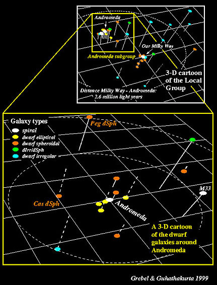
I think this graphic does a good job managing the difficult task of conforming a 3D map to a 2D surface. The additional smaller image at the top provides an effective way for the viewer to contextualize the larger image within the galaxy's larger spectrum. The grid on the map involves a sense of perspective, with the larger boxes that appear closer to the viewer gradually decreasing in size to appear farther away. Becasue the grid is not aligned with the x-axis and y-axis, it looks like it is a plane slicing through a 3D space. Do the x-axis and y-axis have any function here other than to orient the viewer toward an apparently three-dimensional image? We are used to the x-axis and y-axis as guiding markers of measurement and direction. It is unclear whether or not they function similarly in this map.
Subscribe to:
Post Comments (Atom)
No comments:
Post a Comment